Accessibility-Infused Maps
Project Description
In this research, we investigate current methods and tools— both technological and non-technological—that people with impairments use to evaluate the accessibility of the built environment (e.g., streets, businesses) and plan and execute travel. Through participatory design, we actively engage our participants in brainstorming and designing the future of what we call assistive location-based technologies (ALTs)—location-based technologies that specifically incorporate accessibility features to help people with impairments explore, search, and navigate the physical world. Thus far, we have primarily focused on people with mobility impairments but the research agenda is much broader and impacts people of all abilities (sensory, cognitive, and physical). In our CHI'16 paper, we explored: What modern technologies do people with mobility impairments use to evaluate the accessibility of the built environment? What role does technology have in making decisions about travel—both a priori (e.g., when planning) and in situ (e.g., when moving about)? How could future technologies be designed to further improve the way they navigate the physical world? At our CHI'18 SIG, we organized the HCI community to discuss grand challenges and potential solutions under the umbrella of 'inclusive maps.'
Publications
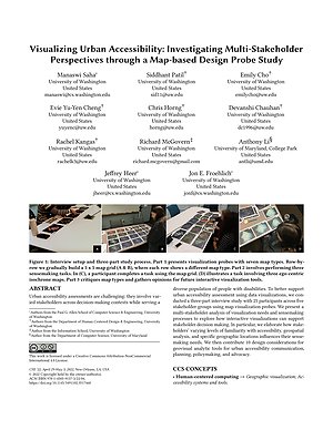
Visualizing Urban Accessibility: Investigating Multi-Stakeholder Perspectives through a Map-based Design Probe Study
Proceedings of CHI 2022 | Acceptance Rate: 24.7% (637 / 2579)
PDF doi Cite Talk Project Sidewalk AccessVis Accessibility-Infused Maps Multi-Stakeholder Interviews to Examine Urban Accessibility
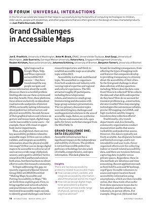
Grand challenges in accessible maps
Interactions 2019

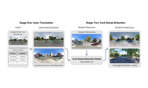
Interactively Modeling and Visualizing Neighborhood Accessibility at Scale: An Initial Study of Washington DC
Extended Abstract Proceedings of ASSETS 2018
PDF doi Cite Project Sidewalk Accessibility-Infused Maps AccessVis
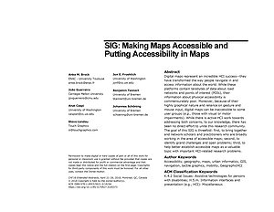
SIG: Making Maps Accessible and Putting Accessibility in Maps
Extended Abstract Proceedings of CHI 2018
The Design of Assistive Location-based Technologies for People with Ambulatory Disabilities: A Formative Study
Proceedings of CHI 2016 | Acceptance Rate: 25.0% (600 / 2400)
PDF doi Cite Accessibility-Infused Maps Project Sidewalk Multi-Stakeholder Interviews to Examine Urban Accessibility
Talks
Crowd + AI Tools for Scalable Sidewalk Assessment
Dec 13, 2021 | Spatial Data Science Symposium 2021
Virtual

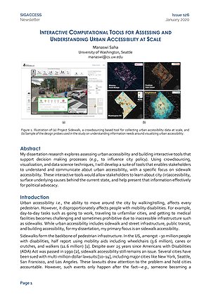
Designing Interactive Computational Tools for Understanding Urban Accessibility at Scale
May 28, 2021 | PhD Generals Exam
Virtual
Project Sidewalk: Mapping the Accessibility of the Physical World at Scale using Interactive Computational Tools
Jan 22, 2020 | Google Tech Talk
Seattle, WA
Project Sidewalk: Mapping the Accessibility of the World through Google Street View
Oct 09, 2018 | Change Seminar
University of Washington, Seattle
Related Projects
![Illustration of a multi-story indoor house layout used in the CapNav benchmark. The diagram asks: “Can [AGENT] go from the basement foyer to the top floor rest area?” The basement foyer (START) is at the bottom left, and the top floor rest area (END) is at the top right. Colored paths show different possible routes through labeled areas including Garage, First Floor Hallway, and Elevator. Icons on the left represent four agent types: a wheelchair user (allowed, green check), a quadruped robot (allowed, green check), a human (allowed, green check), and a sweeping robot (not allowed, red X). Red X markers and warning labels indicate constraints such as “Cannot go up stairs” and “Cannot operate elevator,” showing how different mobility capabilities affect route feasibility.](/media/projects/images/CapNav-Thumbnail.png.500x300_q85_box-135%2C10%2C2826%2C1627_crop_upscale.png)