Project Description
Funding
Publications
Scaling Crowd+AI Sidewalk Accessibility Assessments: Initial Experiments Examining Label Quality and Cross-city Training on Performance
Poster Proceedings of ASSETS'22 | Acceptance Rate: 58.9% (43 / 73)
PDF | doi | Citation | Project Sidewalk • Deep Learning for Sidewalk Assessment
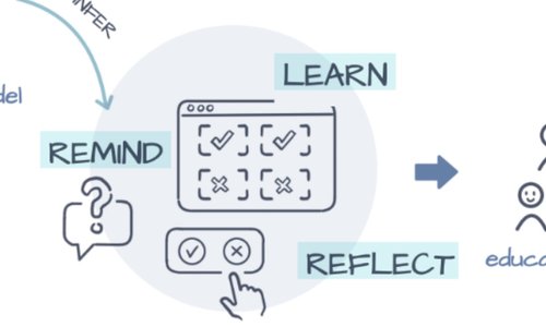
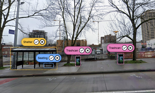
Towards Global-Scale Crowd+AI Techniques to Map and Assess Sidewalks for People with Disabilities
CVPR2022 Workshop: Accessibility, Vision, and Autonomy (AVA)
PDF | doi | Citation | Project Sidewalk • Deep Learning for Sidewalk Assessment

Deep Learning for Automatically Detecting Sidewalk Accessibility Problems Using Streetscape Imagery
Proceedings of ASSETS 2019
|
Acceptance Rate: 25.9%
(41 / 158)
|
 Best Paper Award
PDF | doi | Citation | Code | Project Sidewalk • Deep Learning for Sidewalk Assessment
Talks
Feb. 29, 2024 | NSF Smart and Connected Communities Panel on “Pathways to Transitioning Project Outcomes"
Nashville, Tennessee
PDF | PPTX | Project Sidewalk + Community Science | Project Sidewalk | Deep Learning for Sidewalk Assessment
Jan. 22, 2020 | Google Tech Talk
Seattle, WA
PDF | PPTX | Project Sidewalk | Urban Accessibility Evolution | Transportation Analytics | Deep Learning for Sidewalk Assessment | AccessVis | Accessibility-Infused Maps
Oct. 29, 2019 | ASSETS'19
Pittsburgh, PA
Related Projects