Project Description
PI
Publications
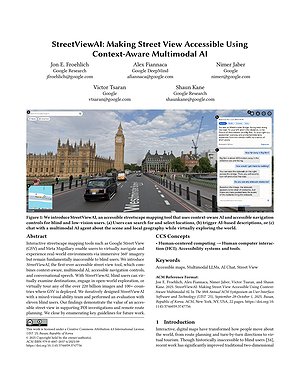
Proceedings of ASSETS 2025 To Appear | Acceptance Rate: 66.1% (82 / 124)
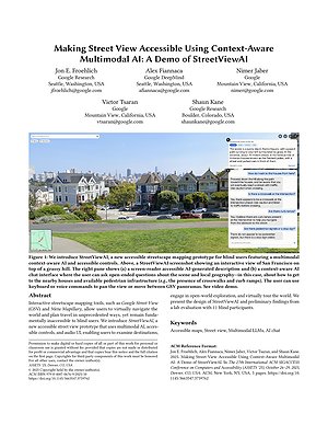
PDF | doi | Citation | StreetViewAI
Proceedings of UIST 2025 To Appear | Acceptance Rate: 22.2% (210 / 947)
PDF | doi | Citation | StreetViewAI
Videos
StreetViewAI: Making Street View Accessible Using Context-Aware Multimodal AI
StreetViewAI: Making Street View Accessible Using Context-Aware Multimodal AI (30-Sec Preview)
Related Projects