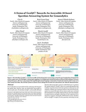
GeoQA^3
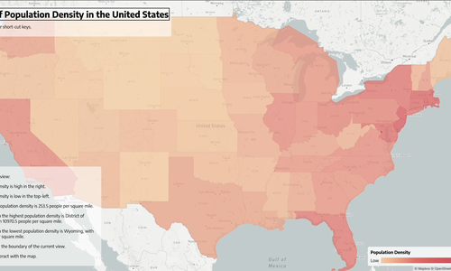
Geovisualizations are powerful tools for communicating spatial information, but are inaccessible to screen-reader users. To address this limitation, we present GeoQA^3, an LLM-based question-answering system that makes geovisualizations accessible through natural language interaction. The system supports map reading, analysis, interpretation and navigation by handling analytical, geospatial, visual and contextual queries. Through user studies with 12 screen-reader users and sighted participants, we demonstrate that GeoQA^3 effectively bridges accessibility gaps while revealing distinct interaction patterns between user groups. We contribute: (1) an open-source, accessible geovisualization system, (2) empirical findings on query and navigation differences, and (3) a dataset of geospatial queries to inform future research on accessible data visualization.