Project Sidewalk Launch!

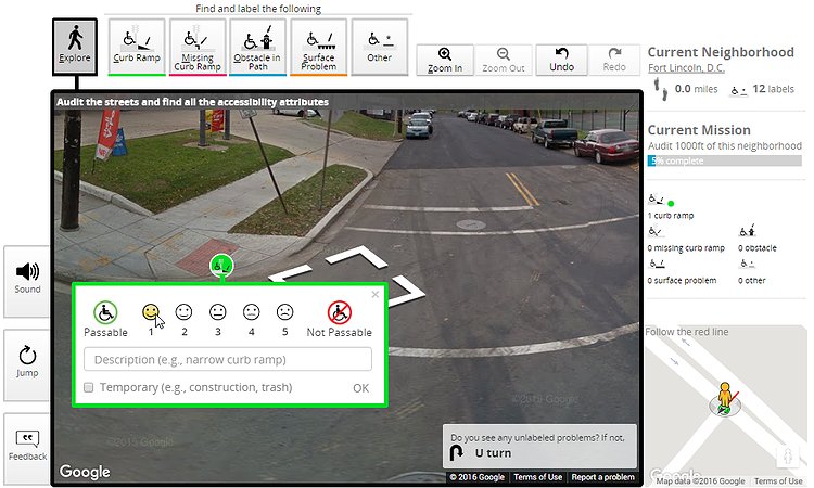
We're excited to announce the beta launch of Project Sidewalk, a transformative new tool that empowers anyone—from motivated citizens and caretakers to government workers and urban enthusiasts—to remotely and quickly label accessibility problems by virtually walking through city streets. Our vision is to fundamentally change the way accessibility information about the built environment is collected and visualized. Imagine, for example, maps that show the accessibility of our cities at-a-glance or a navigation app on your smartphone that provides accessible routes for people with mobility impairments. Join us! Visit http://sidewalk.umiacs.umd.edu to get started! Click “Participate” and complete a few short missions! In private beta testing, 126 users mapped the accessibility of over 245 miles of DC streets--that’s nearly 25% of all streets in the city (and greater than the distance from DC to New York!). With just 10-15 minutes, you can make a difference! DC is just the beginning. Our long-term vision is to deploy Project Sidewalk in every city in the world that has Google Street View! Be a part of this revolution! Help us make the world a better place for everyone!