Project Description
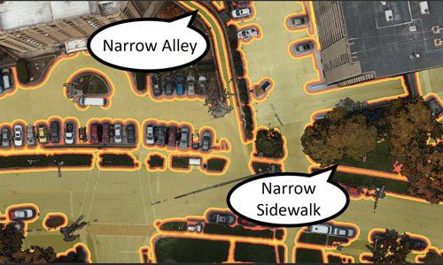
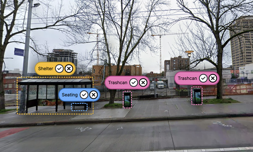
Google Street View (GSV) has become a primary scientific instrument in studying the physical world, from urban forestry to computer vision to sidewalk accessibility. However, little work examines where Google Street View exists and how frequently the GSV pano dataset is updated.
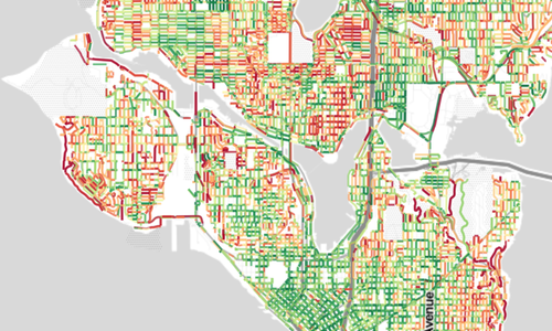
In this project, we aim to analyze Google Street View data collection and examine spatio-temporal patterns such as: (1) What areas of the world are most frequently updated and why might this be (e.g., population density patterns, socio-economics, road types, etc.)? (2) What areas of the world have been most recently updated? (3) Where street view imagery doesn't exist at all?
Related Projects